It is linked by bridges to Seonyudo Island, Jangjado Island and Daejangdo Island. It has an auto campground in front of Munyeodo Island Elementary School, a tidal flat experience area, and Jwittongseom Island, which you can walk to at low tide. In 2018, the Ministry of the Interior and Safety picked it as a 'play island' among islands to visit during the vacation season.
Source: Korea Tourism Organization · KOGL Type 1 · 6 photos
Munyeodo Island The sea today
Nov 4 (Wed)
Open at all times
Tides
Nearest station · 10.9 km away
Tides · Nov 4 (Wed)
Tide
Time
Height
Low tide
05:15
196 cm
High tide
11:00
469 cm
Low tide
17:32
173 cm
High tide
23:40
526 cm
Shown for seaside places only, when the nearest tide station is within 30 km in a straight line. The curve joins the times and heights of high and low tide.
Getting to Gunsan's sights by city bus: route numbers and first and last buses for the Modern History Museum, Gyeongam-dong Railroad Village, Bieung Port, Seonyudo Island, Jangjado Island and Gunsan Airport
November 13 (Fri)–November 14 (Sat), 2026, 1 night and 2 daysOn now or coming up
Munyeodo Island in detail
Munyeodo Island's old name, 'Seodeuri,' and the Lee family's settlement in the late Goryeo period
Munyeodo Island's old name was 'Seodeuri,' meaning an island where you had to move busily and quickly to make a living. According to Munyeodo Island's settlement history, a Lee family first came to live on the island in the late Goryeo period. The name Munyeodo Island came later, because a janggu drum-shaped island and a wine-cup-shaped island beside it looked like a shaman dancing before a table of offerings.
Munyeodo Island's Wanyang Salt Farm: 160,000 pyeong reclaimed with a 1951 seawall, salt making after 1962 privatization
Munyeodo Island's Wanyang Salt Farm opened after the salt monopoly law was abolished (December 1961) and the salt industry was fully privatized on January 1, 1962. The land beneath it is a 160,000-pyeong reclaimed area. Choe Hyeon-chil, a Gunsan native, made it in 1951 by building a seawall over 1 year with about 300 workers. Of Gunsan's 8 salt farms at the time, Wanyang was one of the larger ones on an island. This salt farm brought Munyeodo Island a period of great prosperity.
Munyeodo Island products and terrain: laver, anchovies and clams; salt making on the northern tidal flats; 131 m Munyeobong Peak
Munyeodo Island produces a lot of laver and anchovies and farms clams. On the wide tidal flats along the north coast, salt is made. The island's salt farms once covered 180,000 pyeong. Today only part of them still produces salt, and the old salt farm sites are turning into wetlands. The island has many rice paddies and fields. Its only high mountain is Munyeobong Peak (131 m) in the southwest, and the coastline is deeply indented. There is a shell mound on the hills of Munyeo 1-gu.
Munyeodo Island was chosen as a 'play island' by the Ministry of the Interior and Safety in 2018 and has an auto campground
In 2018, Munyeodo Island was picked as the 'Play Island' for the Gunsan area among the 'islands to visit in the vacation season' chosen by the Ministry of the Interior and Safety. A panel of island and tourism experts and others picked islands under 5 themes: Rest Island, Taste Island, Play Island, Unknown Island and Hard-to-Reach Island. A Play Island is one suited to sports, trekking and camping for small groups such as families or coworkers. Munyeodo Island Auto Campground (19 Munyeodo 2-gil, Okdo-myeon) is in front of Munyeodo Island Elementary School. There you can camp, fish from the coastal rocks and try tidal flat activities.
Can you tour Munyeodo Island together with Seonyudo Island, Jangjado Island, and Daejangdo Island?
Yes. All four islands are linked by bridges, so you can walk from island to island along the Gogunsan connecting road. source 1
Can I park at Munyeodo Island?
Yes. The island is always open with no closing days. For tourist questions, contact the Gogunsan Visitor Support Center tourist information office (063-465-5186). source 2
Can anyone use the Munyeodo Island tidal flat experience area?
No. Only Munyeodo Island Auto Campground users and guests staying on Munyeodo Island can use it. The activity program costs 7,000 won for adults, 5,000 won for middle and high school students and 4,000 won for elementary school students. Hoes, baskets and onion net bags are lent free, but you must bring your own rubber boots. source 1
Can you walk to Jwittongseom Islet from Munyeodo Island?
Yes, at low tide. When the tide goes out, a sea road appears and you can walk across to the two islands. When the tide comes in, they become islands again. Its nickname is 'Moses Road,' and you can see the sunrise there. source 1
Are there guesthouses or restaurants on Munyeodo Island?
Yes. There are 15 homestays in Munyeo 1-gu and 10 in Munyeo 2-gu, and the fishing village cooperative (063-465-0450) takes inquiries. There are 3 restaurants serving raw fish (hoe) in Munyeo 1-gu and 2 in Munyeo 2-gu. source 1
Where does the name Munyeodo Island come from?
It comes from the shape of the island. A wine-cup-shaped island sits beside an island shaped like a janggu drum. Together they looked like a shaman dancing before a table of offerings, so it was called Munyeodo Island. source 1
What was the former name of Munyeodo Island?
It was 'Seodeuri.' The name meant an island where you had to move busily and quickly to make a living. The name Munyeodo Island, taken from the island's shape, came later. source 1
When was Munyeodo Island's Wanyang Salt Farm made?
It began in 1951, when Choe Hyeon-chil and about 300 workers built a seawall over 1 year to create 160,000 pyeong of reclaimed land. The salt farm began operating after January 1, 1962, when the salt industry was fully privatized. source 1
What is the highest mountain on Munyeodo Island?
It is Munyeobong Peak in the southwest of the island, at 131 m. Apart from Munyeobong Peak, the island has no high mountains. source 1


 Seonyu 1-gu Portstraight-line 970 m
 Seonyu Bridgestraight-line 990 m
 Okdol Beachstraight-line 1.0 km


 Namdo Bapsangstraight-line 1.5 km
 Seonyudo Beach
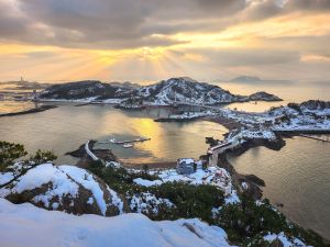 Jangjado Island
 Yamido Wharf
 Seonyudo Island
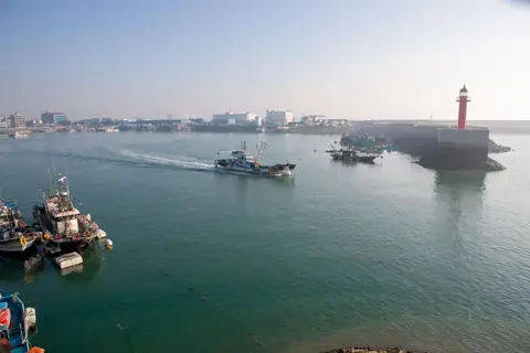 Bieung Port
 Jangjagyo Skywalk
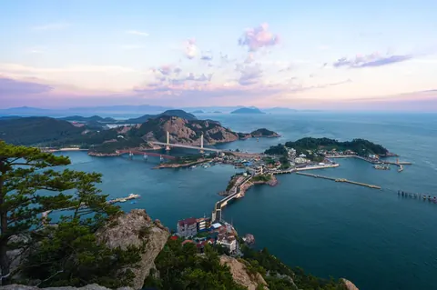 Gogunsan Islands
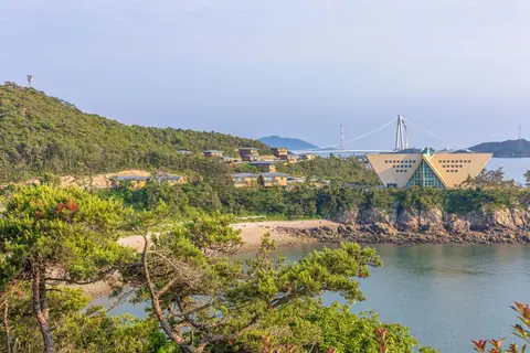 Sinsido National Recreational Forest


