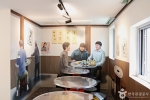
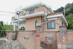
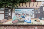
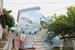
Today residents and artists live there together. The village has 9 artist residence buildings and 8 exhibition buildings, built in 2014 under a Jeonbuk State project to develop leading tourist sites. The village alleys lead to Wolmyeongsan Mountain, where you can see the sea where the Geumgang River estuary meets the West Sea.
Source: Korea Tourism Organization · KOGL Type 3 (no changes allowed) · 6 photos
6 photos ↓ · Source: Korea Tourism Organization · KOGL Type 3 (no changes allowed)
Tourist information in Gunsan: 8 tourist information centers, free tours by culture and tourism guides and the 47-point Gunsan stamp tour, with hours, departure times and completion rules
Public parking near sights in Gunsan: straight-line distance, spaces and fees for Gyeongam-dong Railroad Village, the Modern History Museum, Chowon Photo Studio, Iseongdang, Dongguksa Temple, Eunpa Lake Park, Seonyudo Island and Jangjado Island
How Mallaengi Village formed: Japanese homes in the 1930s–40s and Korean War (6·25) refugee shacks
Mallaengi Village took shape when refugees who settled in Haemang-dong, Sinheung-dong and nearby areas during the Korean War built shacks side by side on the rocks. Over time, this neighborhood of shacks turned into a village full of thatched roofs. Homes first appeared in Sinheung-dong earlier, around the 1930s–40s, when Japanese people built houses and lived around what is now the Japanese-style house (formerly the Hirotsu House).
Mallaengi Village size: about 10,000 m², with 8 exhibition buildings and 9 artist residence buildings (2014)
Mallaengi Village is a village of about 10,000 m² around 34-5 Sinheung-dong. People are moving out of this area, and it is turning into a declining old downtown. Under a Jeonbuk State project to develop leading tourist sites (2014), 8 exhibition buildings and 9 artist residence buildings were built here.
Wolmyeongsan Mountain, linked to Mallaengi Village by alleys: sunset and night views over the Geumgang River estuary and the West Sea
From Wolmyeongsan Mountain, reached by climbing the alleys from Mallaengi Village, you can look down on the sea where the Geumgang River estuary meets the West Sea. To reach Wolmyeongsan Mountain, walk past the village exhibition halls and up the sloping alleys. You can also see the sunset and the night view from there.
It is a village that formed when refugees built shacks side by side on the rocks of a hillside during the Korean War. In 2014, 8 exhibition buildings and 9 artist residence buildings were built, and now residents and artists live as neighbors. source 1
What does 'Mallaengi' in Mallaengi Village mean?
It is a Jeolla-do dialect word for a hillside. The village got this name because it sits on a hillside. source 1
Can you see the sunset or night view from Mallaengi Village?
Yes, you can. Walk past the exhibition halls and up the sloping alleys to Wolmyeongsan Mountain. From there you can look down on the sea where the Geumgang River estuary meets the West Sea, and see the sunset and the night view. source 1
Does Mallaengi Village have accessible parking and restrooms?
Yes. There are 3 accessible parking spaces and accessible restrooms for men and women. However, there is no ramp to the entrance and no wheelchair rental. source 1
Is there an admission fee for Mallaengi Village?
No. It is open all year. Admission is free, it is always open with no closing days, and you can park. source 2
When did Mallaengi Village form?
It is a village that formed when refugees settled on the hillside during the Korean War. Earlier, in the 1930s–40s, homes appeared when Japanese people built houses and lived around the Japanese-style House in Sinheung-dong (formerly the Hirotsu House). source 1
How big is Mallaengi Village?
It is about 10,000 m². It covers the area around 34-5 Sinheung-dong. source 1




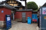 Japanese-style House in Sinheung-dong, Gunsan (Hirotsu House)straight-line 130 m
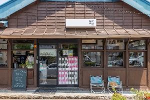 Marie Bookstorestraight-line 260 m
 Chowon Photo Studiostraight-line 380 m


